Fichier:Serbia 2008 CIA World Factbook map with notes.png

Serbia_2008_CIA_World_Factbook_map_with_notes.png(329 × 353 pixels, taille du fichier : 42 kio, type MIME : image/png)

Ce fichier provient de Wikimedia Commons et peut être utilisé par d'autres projets. Sa description sur sa page de description est affichée ci-dessous.

Likwé ya mokusé:

Bolimboli
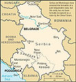
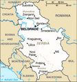
English: CIA World Factbook map of Serbia without Kosovo — from the 2008 edition. Note the disclaimer in the upper right, and the marking of the border with Serbia as a provisional UNMIK line.

The map was taken unmodified from the Factbook, except for conversion to PNG. The notes were in the original, though they have since been removed on the CIA site.

Note: Do not upload a new image with this filename. Use Image:Serbia-CIA WFB Map.png for the later CIA World Factbook map without notes regarding the declaration of independence.
Source The original map was found here, but has since been modified at the source.
Mokeli CIA
Autres versions

[kobɔngisa]

Conditions d’utilisation

Public domain
Cette image est dans le domaine public parce que son contenu provient du World Factbook, édité par la Central Intelligence Agency des États-Unis d’Amérique.

Bahasa Indonesia  čeština  Deutsch  eesti  English  español  Esperanto  français  galego  hrvatski  italiano  Nederlands  norsk nynorsk  polski  português  sicilianu  slovenščina  suomi  Türkçe  Zazaki  беларуская (тарашкевіца)  македонски  русский  српски / srpski  українська  ქართული  বাংলা  தமிழ்  മലയാളം  한국어  日本語  中文  中文(简体)  中文(繁體)  العربية  +/−


Journal des téléversements d’origine

The original description page was here. All following user names refer to en.wikipedia.
  • 2008-03-04 22:50 Anticetnik 329×353×8 (42774 bytes) Map of [[Serbia]] [[Kosovo independence|without]] [[Kosovo]] — from the [[2008]] edition of [[CIA World Factbook]]. The [https://www.cia.gov/library/publications/the-world-factbook/maps/rb-map.gif original map] can be found [https://www.cia.gov/library

Mokóló mwa kásá

Cliquer sur une date et heure pour voir le fichier tel qu'il était à ce moment-là.

Mokɔlɔ mpé ntángoMiniátilɛDimasióMosáleliNtembe
ya sikáwa25 mársi 2008 à 13:12Miniátilɛ ya versió ya 25 mársi 2008 à 13:12329 × 353 (42 kio)Mattflaschen{{Information |Description={{en|en:CIA World Factbook map of en:Serbia without en:Kosovo — from the en:2008 edition. Note the disclaimer in the upper right, and the marking of the border with Serbia as a

Aucune page n’utilise ce fichier.

Usage global du fichier

Les autres wikis suivants utilisent ce fichier :